
Clarksville ZIP Coverage
Official research identifies 47129 as the primary mailing ZIP for Clarksville. The nearby 47130 code belongs to Jeffersonville and appears often because the Clark County courthouse, election office, Recorder, and other county custodians are in the county seat. Their 47130 mailing addresses do not turn that code into a Clarksville ZIP. This distinction keeps an office location from being confused with the place described by its records.
| ZIP | Areas Covered | Post Office | Notes |
|---|---|---|---|
| 47129 | Clarksville mailing addresses, subject to exact-address verification | Clarksville Post Office, 757 E Lewis & Clark Parkway, Suite 814 | Primary town ZIP; delivery area is not the legal town boundary |
| 47130 | Jeffersonville and county-seat office addresses near Clarksville | Jeffersonville-area USPS facilities | Comparison code, not identified as serving Clarksville town addresses |
No separate Clarksville PO-box-only ZIP, unique institutional ZIP, or official split year surfaced in the inspected sources. That is a research gap, not proof that no postal exception can exist. The USPS ZIP Code Lookup remains the controlling check for a specific delivery address.
Note: Record both the Clarksville location and the Jeffersonville custodian so a valid county record is not rejected by ZIP alone.
Verify a Clarksville ZIP Code
USPS lookup accepts street, city, state, and ZIP concepts. Enter the full address, including apartment or suite, and preserve the standardized response. If an old directory uses another spelling or locality, retain the original wording in a separate field. Do not rewrite the old source to match a modern result. Postal standardization answers how mail is delivered now; it does not rewrite the historical record.
| Search field | Type | Use in Clarksville | Limit |
|---|---|---|---|
| Street address | Address text | Confirm number, name, suffix, and unit | Must be exact for a precise result |
| City | Place text | Test the accepted postal city | Postal city is not a municipal boundary |
| State | State selection | Use Indiana | Does not narrow to Clark County alone |
| ZIP | Five-digit code | Confirm 47129 or test a supplied code | Does not prove occupancy or ownership |
The Clarksville Post Office observed in the official route is at 757 E Lewis & Clark Parkway, Suite 814, with phone 812-283-1396. Posted retail hours can change, so check the live listing before a visit. The failed manifest capture for the USPS tool is not used as an image; only successful page-assigned images appear below.
Find Clarksville Residents by ZIP
A ZIP code directory can reduce a broad name search, but no researched Clarksville source offers one universal ZIP roster. Use the postal result as a filter, then move to the source that fits the question. XSoft can search property and owner concepts. Elevate can confirm a parcel on the map. Indiana Voters handles an individual status check, while computerized voter products require the county process and lawful approved use. State license, entity, and unclaimed-property portals use ZIP in different ways and prove different public roles.
- Verify the exact mailing address through USPS and save the returned city, state, ZIP, and date.
- Check Clark County XSoft or Elevate GIS for the parcel, situs address, and map position.
- Search a name only in the record system tied to the question. Preserve its status date and role label.
- Compare the mailing ZIP with the physical parcel and record custodian. Stop if the match is protected or ambiguous.
Once the work narrows from 47129 to one road, use the Clarksville street directory for the street-level property and deed chain. ZIP geography should not be stretched into a claim about who occupies a particular home.
Clarksville Address Labels Differ
A Clarksville parcel can carry several address labels. The situs address is the physical parcel location. The owner’s tax mailing address may be elsewhere. A deed may rely on a legal description, subdivision, lot, block, or metes-and-bounds text rather than a ZIP. Older directories and Sanborn maps may show a former number or regional postal heading. Preserve each label with its source and date.
- ZIP code
- A five-digit USPS delivery-area code, not a legal municipal boundary.
- ZIP+4
- A delivery refinement for a smaller segment, building, or group of boxes.
- PO-box ZIP
- A code used for post-office boxes; no separate Clarksville-only example was established.
- Unique ZIP
- A code assigned to one large recipient; none was found for Clarksville.
- Carrier route
- A postal delivery path that can cross other civic or neighborhood lines.
Clarksville Code §95.41 says existing street, apartment, and mobile-home numbers remain official unless ambiguity requires correction. New numbers are assigned in a logical sequence and shared with public-safety, street, wastewater, emergency, and postal functions. Annexed areas generally retain existing numbers when possible. No dated townwide renumbering was found, so confirm a suspected change with a map, plat, deed, or town record.
Clarksville ZIPs and Town Limits
A ZIP code describes mail delivery. It does not define the Clarksville town boundary, Clark County boundary, voting precinct, zoning district, school area, historic district, or social neighborhood. The mismatch is especially easy to see here because Clarksville residents use county offices in Jeffersonville. A courthouse address in 47130 tells where the custodian works, not where every party in the file lives.
Boundary check. Treat 47129 as a postal filter. Use the town, parcel, zoning, or precinct source when that specific boundary is the question.
No official school-attendance-zone finder or public utility-customer address lookup surfaced in the Clarksville research. Do not infer those service areas from a ZIP. Planning and Zoning, the Building Commissioner, XSoft, Elevate, and the Town Clerk are the practical sources for an annexation, address assignment, or correction record.
The “one ZIP equals one town” idea fails in many record searches. Even where 47129 is the primary Clarksville code, an old volume can place Clarksville material under a Jeffersonville or New Albany regional title. Keep the page heading and locality printed in the source.
Clarksville Parcel Joins Beat ZIP
For property questions, a parcel ID is usually more exact than a ZIP code. XSoft supplies current assessor-style owner and property concepts, with a covered-person warning and an as-of date. Elevate adds parcel geometry, identify tools, layers, a legend, and printing. County directions say zoning can be turned on through Map Contents and “Zoning - County,” though the current portal wording should be checked because county pages have carried both Beacon and Elevate references.
Tapestry can bypass postal uncertainty through parcel number, subdivision, lot, block, legal description, document number, party name, document type, and recorded-date fields. That is useful when a deed predates ZIP use or a road name changed. The Clark County Recorder’s online deed and miscellaneous index reaches back to November 1999; older land research may require office or library indexes.
The chain is simple: USPS address to current parcel, parcel to assessed owner, then parcel or legal description to recorded instruments. Each step answers a narrower question. None alone proves present occupancy. A ZIP code directory adds geographic order, while parcel and deed sources provide the record-specific evidence.
ZIP Filters Across Clarksville Records
Indiana portals do not give ZIP the same meaning. PLA Search and Verify includes city, county, state, and ZIP among its credential fields. INBiz may show principal or registered addresses for an entity. Indiana Unclaimed accepts city and ZIP as search terms. A result from any of these systems is a dated public role, not a resident roll.
| Portal | ZIP-related input | Result meaning |
|---|---|---|
| USPS | Exact address and ZIP | Current delivery formatting |
| XSoft / Elevate | Property address or selected parcel | Assessor and map context |
| PLA | City, county, state, ZIP | Public license or facility record |
| INBiz | Entity and public filing address concepts | Business filing role |
| Indiana Unclaimed | Name, city, ZIP, property ID | Potential state-held property claim |
The statewide voter portal should be used for the minimum individual status need. State Form VRG-24 controls computerized voter products, including countywide, township, precinct, vote-history, registration, and walking-list choices. The research did not establish a ZIP-specific Clarksville voter statistic or casual ZIP export. Do not invent one from another dataset.
Protected Clarksville ZIP Records
A missing address may reflect deliberate protection. Indiana’s Address Confidentiality Program provides a substitute address to eligible victims and sends notice to county election officials. Protected voter names, addresses, phones, and identifiers receive restricted handling. XSoft also displays a covered-person notice under IC 36-1-8.5. A ZIP match must never be used to reconstruct a hidden street address.
The Attorney General’s Address Confidentiality Program page explains the substitute-address service.

The program is not a general opt-out and does not erase every public record, but its safeguards must be honored wherever they apply.
The Secretary of State voter guidance covers the election-record side.
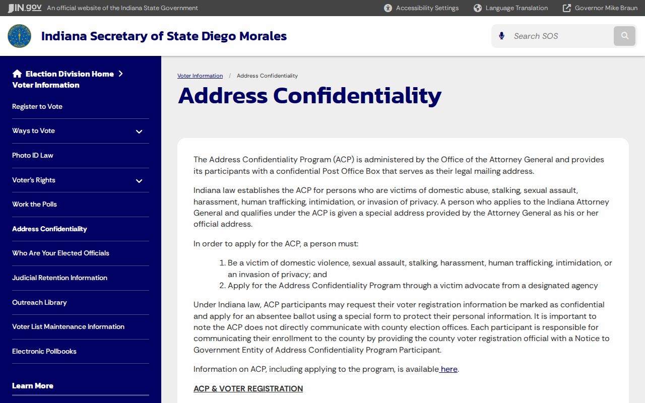
Together, the official pages show why a non-match can be a protection issue rather than a bad ZIP search.
Clarksville Records Before ZIP Codes
Historical Clarksville research often has no ZIP at all. Regional Caron directories may place Clarksville entries inside volumes titled for New Albany or Jeffersonville. Census schedules, deed books, plats, newspaper notices, and the 1911 Sanborn set use the locality, street, legal description, household, or map sheet available in their era. Search those features first, then connect the result to a modern address only after a dated map or deed supports the join.
Lewis & Clark Parkway is a strong current geographic anchor, and South Clarksville’s trail network is described as 8.7 miles south of the Parkway. These details help orient a parcel, but they do not identify a resident. Clarksville had 22,333 people in the 2020 Census and an estimated 22,253 in 2025. Those figures provide scale only; Census QuickFacts is not a name directory or ZIP-level roster.
Town history, annexation records, plats, and code files are better tools when an old Clarksville address appears to cross a modern line. Keep both the original address and normalized postal form until the evidence connects them.
Clarksville ZIP Privacy Boundaries
Motor-vehicle records are not a shortcut to a resident address. Indiana BMV describes federal Driver’s Privacy Protection Act rules and state limits on personal data. A postal code found in another lawful public record does not open restricted vehicle information.
The Indiana BMV data programs page states that boundary.
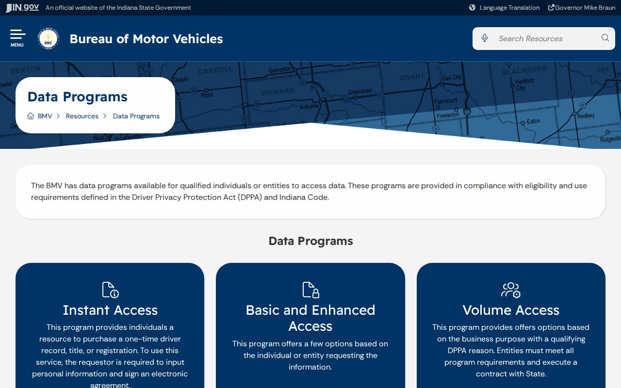
The captured page reinforces the core rule: use each Clarksville source only for the purpose and fields it lawfully provides.
Under the Indiana Access to Public Records Act, IC 5-14-3, a request can seek an existing, well-described record. It cannot force an office to build a new list of Clarksville residents grouped by ZIP. When a portal lacks the needed view, request the specific parcel, permit, filing, or dated public product instead.