
Trace a Clarksville Street
A Clarksville street directory search works best as a chain, not as one search box. Start with the address exactly as it appears on a letter, deed, or old directory. Keep apartment numbers, directions, and street suffixes. The Clark County assessor can connect that form to a parcel, while the map can show whether the point sits inside the expected block. A current owner is only one dated fact. To learn who lives or once lived there, compare other public records and historical sources.
- Enter the full address in the Clark County XSoft property search. Save the situs address, parcel ID, owner display, mailing address, and data date.
- Open the same parcel in Elevate GIS. Check the road label, boundary, nearby parcels, map scale, and useful layers before moving along the street.
- Use the owner name, parcel ID, subdivision, lot, or block in the Recorder's current systems. Read the instrument image when access allows.
- Ask the Clark County Voter Registration Office about the lawful request route when voter data is relevant. Protected fields and addresses stay closed.
- For an older household, compare dated directories, census pages, newspapers, deeds, and maps in the JTPL Indiana Room.
The chain keeps ownership, occupancy, and geography apart. It also makes a blank result useful. A missing hit may reflect an old number, a parcel split, a protected record, a regional directory heading, or an index that does not cover that year.
Clarksville Street Search Fields
The county-linked XSoft property search is the practical first stop for current Clarksville property clues. Its covered-person notice cites Indiana Code 36-1-8.5, so some names or addresses may be restricted. The portal also shows a disclaimer and an as-of date. Save both. Dynamic controls can change, but the research captured the main concepts that join a street address to later records.
| Search concept | Best use by address | Check before relying |
|---|---|---|
| Owner name | Find parcels tied to the displayed assessor owner | A name may be short, shared, protected, or an entity |
| Property or situs address | Match street number, name, town, and ZIP | Test directions and suffix forms |
| Parcel or property ID | Join assessor, map, tax, and deed searches | Old deeds may use a prior ID |
| Situs and mailing address | Separate land location from tax-mail destination | The mail recipient may not occupy the site |
| Class, assessment, and sales | Add dated tax and market context | Assessment is not a title finding |
In a street-by-street worksheet, keep one row per parcel and one source date per fact. Do not merge the situs and mailing fields. Their difference may be meaningful, yet neither field names every person at the address.
Map Clarksville Streets by Parcel
Clark County Elevate GIS is stronger than a name list for following a whole block. Pan along the road, select one parcel at a time, and note each displayed situs and parcel ID. County instructions say the county zoning layer can be turned on through Map Contents and the legend. Record the base parcel view first, then add zoning, flood, or district layers only when they answer a clear question.
A Clarksville street directory built from the map should retain the selected parcel, neighboring boundaries, road name, orientation, scale, and capture date. It should not promise a whole-street export because the inspected portal did not expose a reliable sort or export control. GIS establishes shape and adjacency. The Recorder and assessment systems have different legal and tax purposes.
The county land and property page explains the linked property routes. The captured county page below is a useful source menu, while each linked record still needs its own date and label.
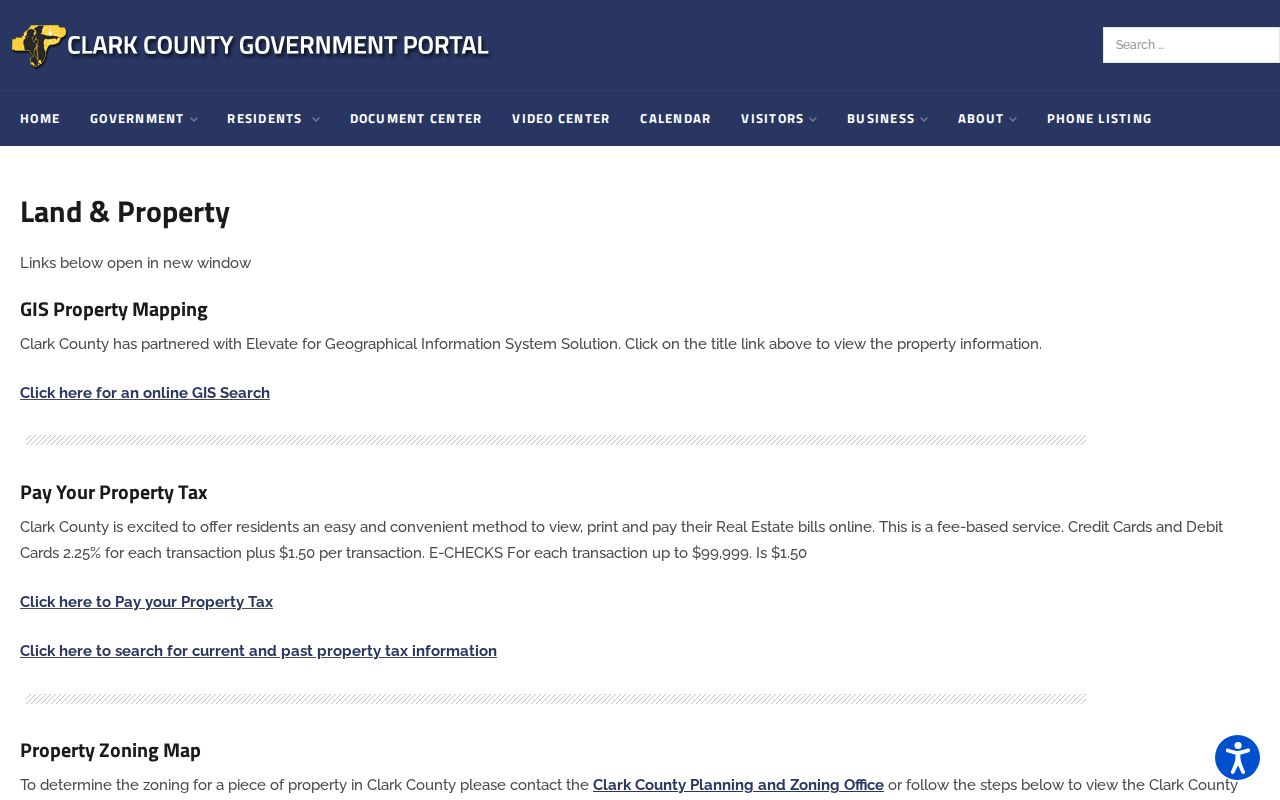
The screenshot helps identify official starting points for Clarksville parcels, taxes, sales, and maps without treating them as one combined resident roll.
Clarksville Records Indexed by Address
No public source is a complete Clarksville street directory. Each address-keyed set covers a narrower fact. The parcel ID is often the cleanest bridge among property and deed systems. A street name joins permits, maps, and some historical sources, but spelling and numbering must be checked.
| Address record | Clarksville custodian | Useful street evidence | Access route |
|---|---|---|---|
| Assessment record | Clark County Assessor | Situs, owner display, parcel ID, assessment context | XSoft online search and office follow-up |
| Parcel map | Clark County GIS | Boundary, road adjacency, nearby parcels, shown layers | Elevate viewer |
| Recorded instruments | Clark County Recorder | Grantor, grantee, date, type, legal description | Tapestry or Laredo, Recorder, older indexes |
| Town permits | Clarksville Building Commissioner | Site, applicant, permit, inspection, certificate, status | SmartGov and public-record request |
| Historical address evidence | JTPL Indiana Room | Directories, census, maps, deeds, newspapers | Research room, microfilm, database, staff request |
Clarksville is a town, but its county property and deed custodians are in Jeffersonville. That split is normal. Label the property as a Clarksville situs and the office as a Jeffersonville custodian so the source is not discarded by mistake.
Clarksville Deeds Along a Street
The Clark County Recorder carries the recorded instrument trail. The online deed and miscellaneous index reaches back to November 1999. Tapestry supports grantor or grantee, dates, document type, parcel, subdivision, lot and block, consideration, document number, and metes-and-bounds terms. Laredo is the subscription route described by the Recorder. Its current agreement date is time-sensitive.
If a street-name search fails, try the parcel number, exact subdivision name, lot and block, legal description, former owner, and an older spelling. Tapestry warns that search clicks may cost money and exact matching matters. Earlier work moves to the Recorder counter, courthouse plats, JTPL historical grantor and grantee indexes, and State Library microfilm. That fallback matters because a street directory query may span far more years than the online index.
The source view below comes from the Recorder's official page. It grounds the online and counter routes in the office that keeps Clark County instruments.
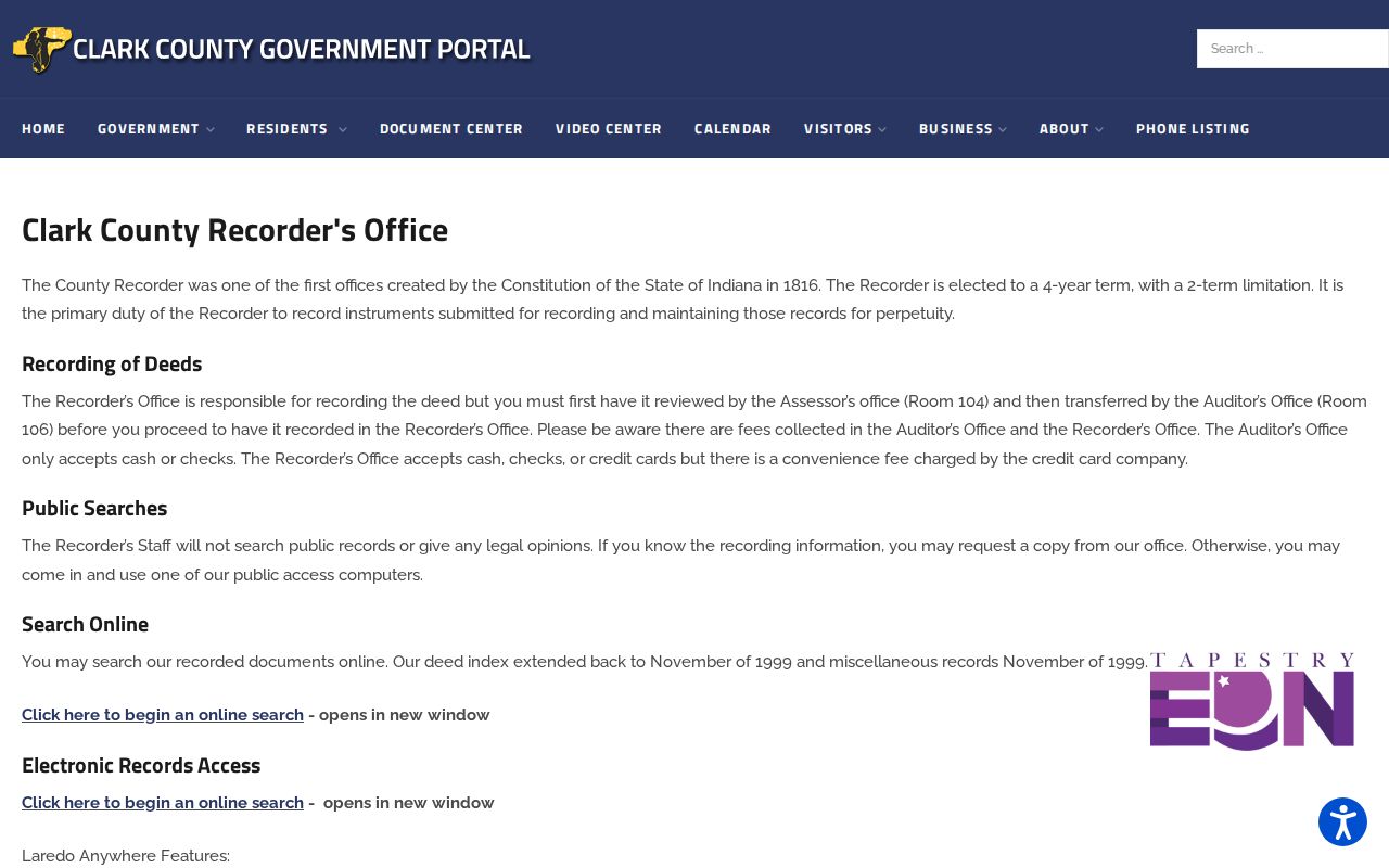
Use the displayed office instructions to confirm current systems before paying for a search or asking for a copy.
Note: A grantee on one deed and an assessor owner are dated facts, not proof of every person living there.
Clarksville Street Directory Terms
Address research uses several terms that look alike but do different work. Defining them early prevents a modern property card from being read as a live household list or an old map from being read as title evidence.
- Parcel
- A mapped unit of land with an identifier used to join assessment, GIS, tax, and some recorded-document data.
- Situs address
- The physical location assigned to land or a structure, which may differ from the owner's mailing address.
- Plat
- A recorded map that names a subdivision and lays out lots, blocks, streets, and other boundaries.
- Criss-cross directory
- A directory arranged by street or phone rather than name. No complete dedicated Clarksville run was confirmed.
For older Clarksville streets, legal descriptions can be more stable than house numbers. Preserve the old number, the current postal form, the parcel ID, and the source that links them. Combine them only after a dated plat, deed, map, or town record confirms the match.
Clarksville Permits by Street
The Clarksville SmartGov portal is the municipal address layer. It can expose permits, licenses, inspections, certificates, documents, code complaints, and zoning-record requests. A file may show an applicant, owner, contractor, designer, site address, parcel, type, issue date, status, inspection result, and attachment. It does not name each person who used the site.
Town Code section 150.021 describes application material such as contact details, a site plan or survey unless exempt, plans, required design release, structural details, other compliance information, and fees. Section 150.170 covers enforcement authority. When the portal does not return an older Clarksville address, use the Building Commissioner or an Indiana Access to Public Records Act request for an existing record. The agency need not create a new street roster.
The public SmartGov screen shows the current path into Clarksville permit and inspection records.
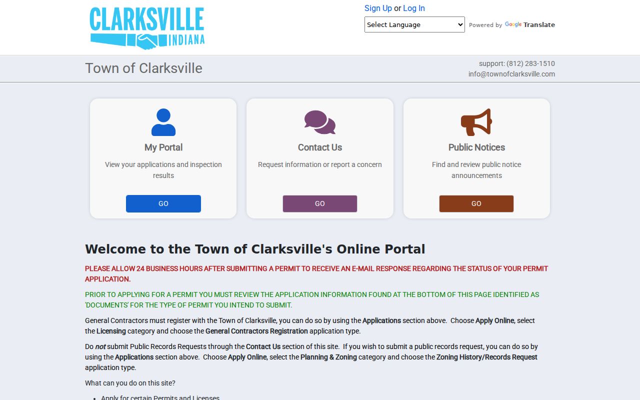
Its address search adds building history to a parcel chain, but each result must be read at the date and status shown.
Keep Clarksville Address Forms Separate
Clarksville Code section 95.41 says existing street, apartment, and mobile-home numbers remain official unless ambiguity calls for correction. New numbers are assigned in a logical way and shared with public-safety, street, wastewater, emergency, and postal functions. Annexed areas generally keep a number when possible. The research found no dated townwide renumbering project, so one should not be invented to explain a mismatch.
Use two fields in a street directory worksheet: “address as recorded” and “current normalized address.” Verify the mailing form with USPS, but remember that ZIP 47129 is a delivery area, not the town boundary. Lewis & Clark Parkway also needs the exact suffix and direction used by the source. A parcel ID, plat lot and block, or legal description can bridge an address change that a plain street search misses.
The official Clarksville address rule is shown in the captured page below.
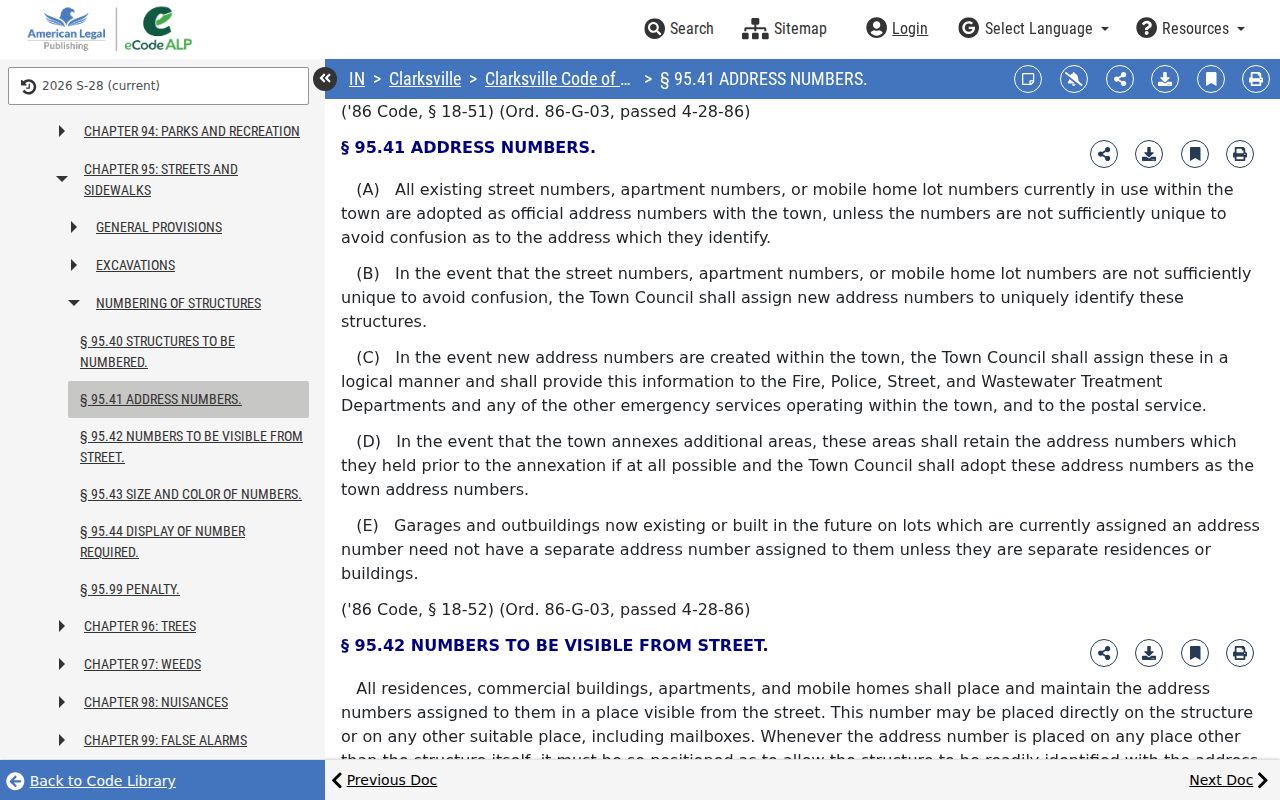
That rule explains the assignment process, while a dated map, plat, deed, or town file must prove a specific old-to-new match.
Centralia Court Street Evidence
Centralia Court gives Clarksville a bounded street-history test. The town's preservation notice says the historic place was platted in 1926 and has 35 homes on two streets. Five originals date to the late 1920s, 21 homes to the 1940s and 1950s, and four to 1956 through 1965. Those build phases make it possible to compare plat lines, current parcel shapes, permit dates, recorded legal descriptions, and historical maps without turning the case into a claim about all Clarksville streets.
This numbers-based example also shows what the records cannot do alone. A National Register narrative describes a place and its building stock. Elevate shows parcels. SmartGov may show modern work. Deeds identify parties to recorded transfers. None supplies a complete current household roll. The street directory result should say which fact comes from which source.
Older Clarksville Streets and Maps
JTPL lists Sanborn map years for the Jeffersonville and Clarksville area in 1886, 1898, 1904, 1911, and 1925. The Library of Congress 1911 set is titled for Jeffersonville but names Clarksville, Claysburg, and Port Fulton as secondary locations. Search the sheet index, not only the title. A sheet can show a street name, number, footprint, use, and construction context for that map era.
Historical directory titles have the same regional trap. A Clarksville government entry sits inside the 1909–1910 Caron regional volume, but the sampled block is not a full household directory. No official complete Clarksville criss-cross run was confirmed. For the collection years and careful reading method, use the Clarksville city directory collection rather than assuming every regional title is arranged by address.
Note: A map footprint or civic roster is dated evidence, not proof that a named person occupied a building.
Limits of Clarksville Street Directory
Public address records do not reveal every Clarksville resident. The assessor may show a tax owner or entity. A deed records parties to an instrument. A permit names people involved with a project. The voter process protects confidential information, and the Address Confidentiality Program can substitute an address for eligible participants. XSoft also warns that covered people may have restricted name or address data.
Motor-vehicle personal data is restricted under federal and Indiana rules. No public utility-customer lookup was found. A missing parcel owner can be intentional, and an absent voter hit proves little. Use the custodian's request path when a lawful public record exists, but do not ask staff to create a new list or reveal a protected field.
Use address records with care. Clarksville records support lawful personal research and civic transparency. Never use an address trail to stalk, harass, threaten, or harm a person.
A careful Clarksville street directory keeps uncertainty visible. Mark the record type, date, custodian, search form, and any restriction. If the task narrows to verifying one name rather than surveying a road, move to the Clarksville resident lookup and confirm the identity across separate indexes.